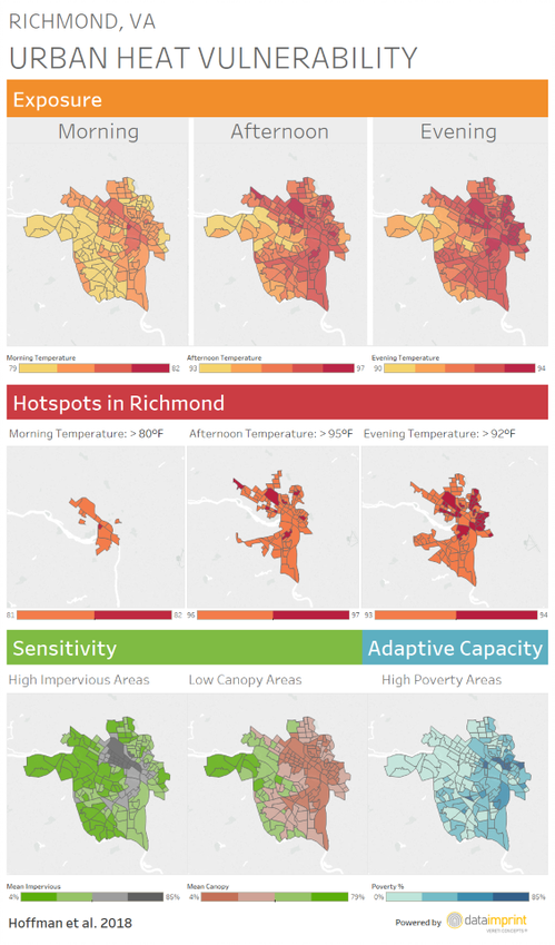
URBAN HEAT VULNERABILITY
Global warming is more than a problem of rising temperatures, it's a concern for the affects it has on our environment and health. It was a pleasure to work with Dr. Jeremy Hoffman, earth scientist and researcher at the Science Museum of Virginia to produce this Heat Vulnerability Visualization. We are moving the conversation beyond is "Global warming happening?" to discuss, "What are we going to do about it?" In this viz we compare the high impervious areas and low canopy areas to temperatures on a summer day in July. No surprise that the unshaded urban areas are the hottest. When combined with economic factors we see that these are also high poverty areas. People living in these hotspots have the highest vulnerability to weather related health issues. The data collected in this research was for Richmond, VA. We feel that these conditions exist in most major cities. This viz was developed and published in September.
Last week The White House released its sweeping National Climate Assessment. The 1,656-page report, compiled by 13 federal agencies and more than 300 researchers, painted the bleakest portrait of the future United States yet.
Learn more about our data solutions here.

